Our aerial drone surveying service provides a cost-effective, time-saving benefit to your cherished business. We work with you to develop an accurate plan that fits your business objectives and requirements.
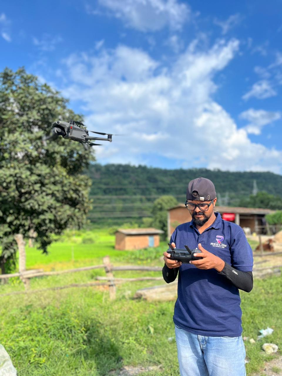
Reelon Air is a renowned aerial survey company that serves the Government and the private sector. We have gained unparalleled expertise in geospatial services over the years, thus enabling us to provide clear-cut aerial drone surveying/Mapping services across India. Quality is the company's top priority and, as a result, it can produce highly accurate topographic maps with accuracy at any given time. We are equipped with high-end surveying drones and have a vast network of drone pilots who can help you reach anywhere. In this way, our clients can obtain deliverables more quickly.

Reelon Air specializes in GIS-based mapping using advanced drone technology. Our drones capture high-resolution imagery and data, which is then processed and integrated into GIS software to create detailed maps and models. These precise maps support a range of applications, including land use planning, environmental monitoring, and infrastructure management. Our GIS mapping services provide cost-effective, timely, and accurate geospatial insights for your needs.
Get in CallReelon Air excels in 3D modeling through our state-of-the-art drone capabilities. Equipped with cutting-edge cameras and sensors, our drones collect detailed aerial data to create immersive three-dimensional models. Our specialized software processes this data to produce accurate 3D representations of landscapes, structures, and environments. Our 3D mapping services offer valuable insights for applications like architectural visualization, construction planning, and virtual tourism experiences.
Get in Call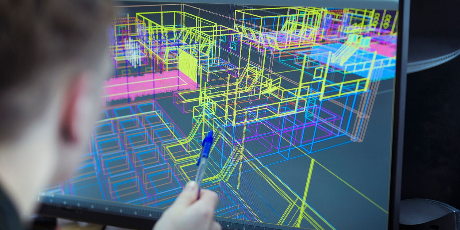
Reelon Air provides comprehensive urban and rural planning solutions using advanced drone technology. We capture detailed aerial data that is crucial for effective city and countryside development. By utilizing high-resolution imagery and advanced mapping techniques, we help analyze land usage patterns, infrastructure placement, and environmental factors. Our data-driven approach supports planners, architects, and policymakers in making informed decisions for sustainable and efficient urban and rural landscapes.
Get in CallReelon Air offers specialized road inspection services using state-of-the-art drone technology. Our drones conduct thorough aerial assessments of roads and transportation networks, capturing high-definition imagery and data. This enables efficient identification of road conditions, wear, and potential hazards. By leveraging our drone-based road inspection, clients can enhance maintenance planning, improve road safety, and ensure the longevity of their infrastructure investments.
Get in Call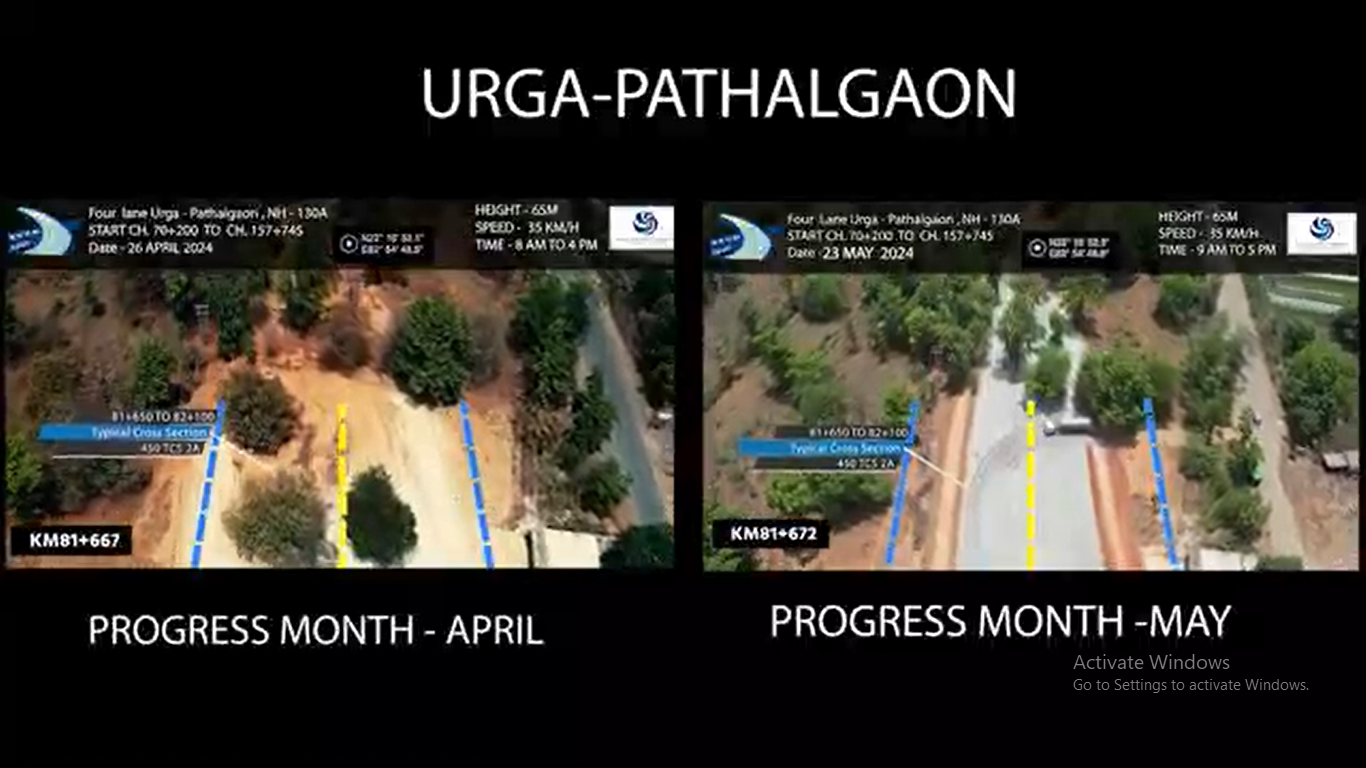
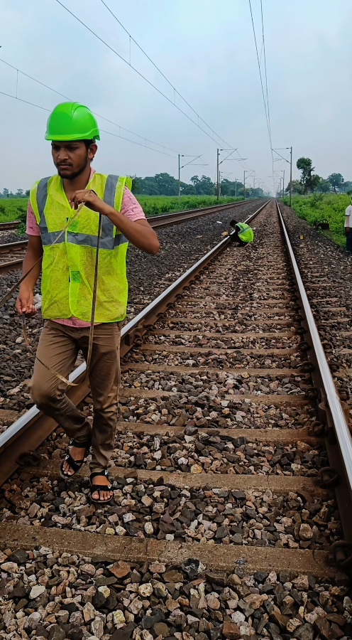
Reelon Air leads in railway track and bridge inspection with advanced drone technology. Our drones perform comprehensive aerial assessments of railways and bridges, capturing precise imagery and data to detect structural issues, track conditions, and maintenance needs. Our drone-based inspection services help clients in the transportation sector optimize maintenance schedules, enhance safety protocols, and ensure the integrity of critical railway and bridge infrastructure.
Get in CallReelon Air is a top provider of LiDAR surveys using advanced drone technology. Our drones, equipped with LiDAR sensors, capture detailed 3D data of terrains, objects, and environments. This technology allows us to create accurate digital elevation models, assess vegetation density, and map complex landscapes. Our LiDAR survey services offer valuable insights for forestry analysis, flood modeling, and urban planning, enabling precise decision-making and resource management.
Get in Call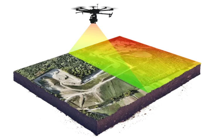
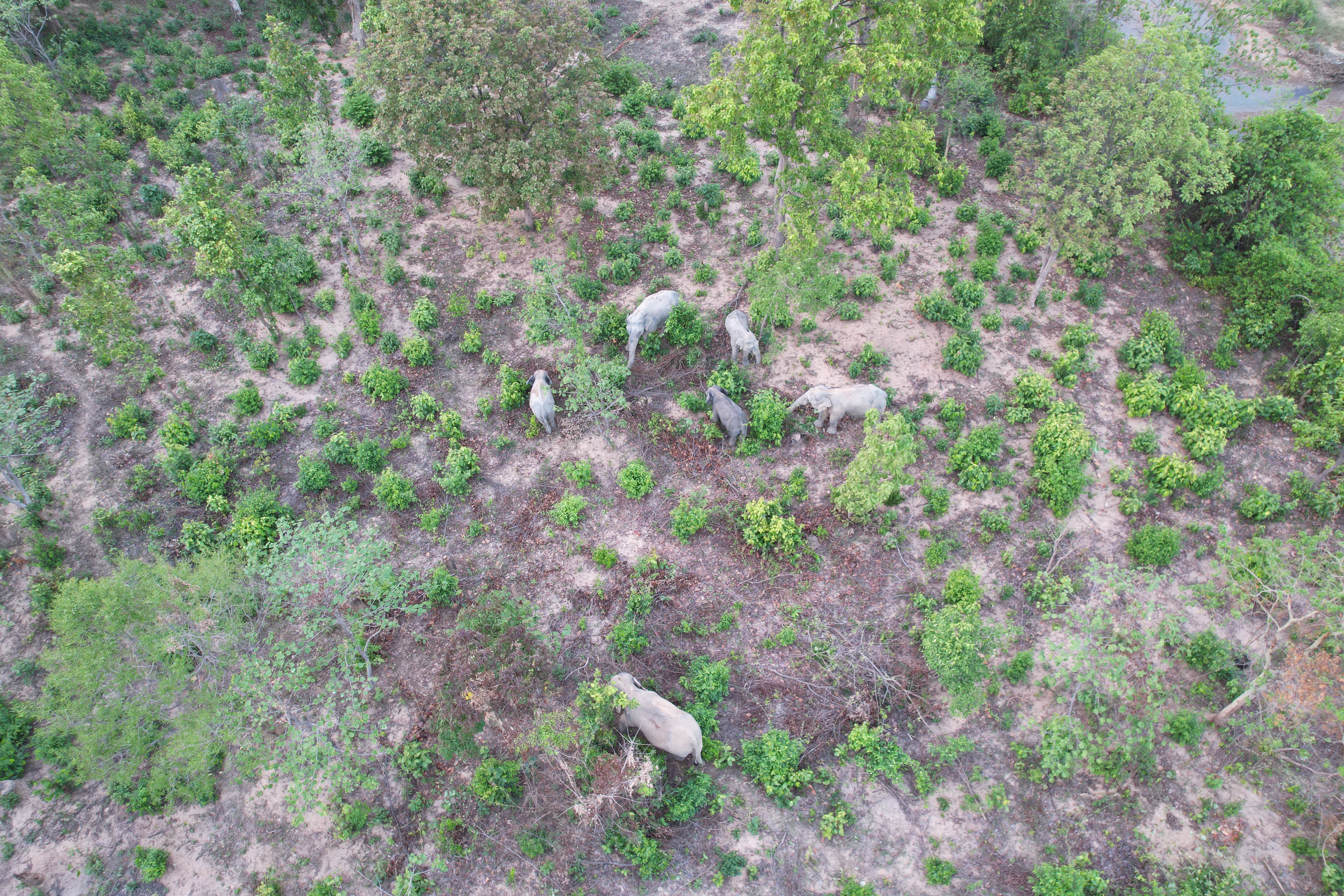
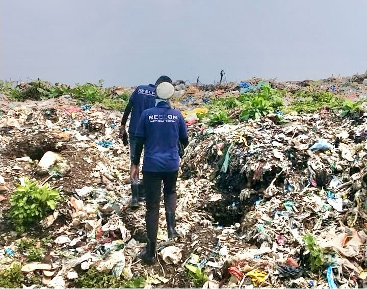
Reelon Air specializes in forest inspection and management using cutting-edge drone technology. Our drones, equipped with high-resolution cameras and LiDAR sensors, conduct comprehensive aerial assessments of forests. We provide detailed data on vegetation health, tree density, and potential threats like disease or fire risk. Our drone-based forest management services help clients in the forestry sector enhance conservation efforts, monitor ecosystem health, and make informed decisions for sustainable resource management.
Get in CallReelon Air offers efficient cadastral map digitalization through advanced drone technology. Our drones capture high-resolution imagery and geospatial data, enabling accurate mapping of land parcels and property boundaries. This digitalization process improves land record accuracy, simplifies land administration, and supports urban planning. Our drone-based cadastral map digitalization services streamline land management and enhance decision-making in real estate and land development projects.
Get in Call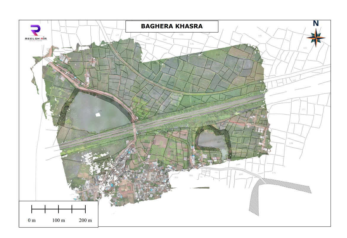

Copyright © 2023. All Rights Reserved By Reelon. Designed & Developed by Programmics Technology.