
In the rapidly evolving landscape of surveying, drones have emerged as pivotal tools, transforming traditional methodologies with their unparalleled capabilities in data acquisition and analysis. This article explores how drones are reshaping modern surveying techniques across various industries, highlighting their impact, benefits, and future prospects.
Understanding Drone Technology in Surveying
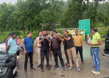
Drones, also known as unmanned aerial vehicles (UAVs), leverage advanced technologies such as high-resolution cameras, LiDAR sensors, and GPS systems to capture precise aerial data. This data is instrumental in creating detailed maps, 3D models, and comprehensive spatial analyses, revolutionizing the accuracy and efficiency of surveying operations.
Benefits of Drones in Surveying
- Precision and Accuracy: Drones enable surveyors to collect data with unprecedented precision, facilitating accurate measurements and mapping. This capability is invaluable in sectors requiring detailed spatial information, such as construction, agriculture, and environmental monitoring.
- Efficiency and Cost-effectiveness: Compared to traditional surveying methods, drones significantly reduce time and costs associated with data collection. They can cover large areas swiftly, providing real-time insights that expedite decision-making processes and project timelines.
- Accessibility and Safety: Drones access remote or hazardous environments safely, minimizing risks to personnel and equipment. This accessibility enhances surveying capabilities in challenging terrains, including rugged landscapes and industrial facilities.
- Versatility in Applications: Drones support a diverse range of surveying applications, including topographic mapping, infrastructure inspection, crop monitoring, and disaster response. Their adaptability to various tasks underscores their value across multiple industries.
Applications Across Industries
Construction and Engineering: In construction projects, drones monitor site progress, conduct site surveys, and assess structural integrity. They facilitate efficient project management by providing real-time updates and ensuring compliance with design specifications.
Agriculture: Drones optimize agricultural practices by monitoring crop health, analyzing soil conditions, and managing irrigation systems. Farmers leverage drone-collected data to enhance productivity, reduce resource use, and improve crop yields.
Infrastructure Inspection: Drones inspect infrastructure assets such as bridges, roads, and pipelines, identifying defects and facilitating proactive maintenance. These inspections enhance infrastructure safety, durability, and operational efficiency.
Environmental Monitoring: Environmental agencies utilize drones for habitat mapping, wildlife monitoring, and pollution assessment. Drones contribute to conservation efforts by providing critical data on ecosystem health and biodiversity.
Future Trends and Innovations
The future of drones in surveying promises continued innovation and integration of advanced technologies. Artificial intelligence (AI) and machine learning algorithms enhance data analysis capabilities, enabling drones to autonomously interpret and report survey data in real-time. Cloud-based platforms facilitate seamless data storage, sharing, and collaboration among stakeholders, fostering greater transparency and efficiency in surveying projects.
Challenges and Considerations
Despite their benefits, drone surveying faces challenges such as regulatory compliance, privacy concerns, and technological limitations. Addressing these challenges requires ongoing collaboration between industry stakeholders, regulatory bodies, and technology developers to ensure safe, ethical, and sustainable drone operations.
Conclusion
In conclusion, drones play a transformative role in modern surveying techniques by empowering industries with advanced capabilities in data acquisition, analysis, and decision-making. Embracing drone technology enables organizations to enhance operational efficiency, reduce costs, and mitigate risks associated with traditional surveying methods.
As drones continue to evolve and expand their applications, they will undoubtedly redefine the future of surveying, unlocking new possibilities for innovation and sustainable development. By harnessing the power of drones, surveyors and industry professionals can navigate complex challenges with confidence, paving the way for a more connected and resilient future.